GIS
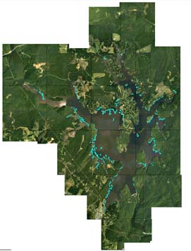
Original aerial photography was assembled into a large map.
The Center uses global positioning systems (GPS) equipment and geographic information systems (GIS) technology in the field and in the laboratory. Field applications include location and response to fish kills, tracking effluent and other pollutant spills, and nutrient monitoring. Laboratory applications include mapping point and non-point pollution sources, imaging of various hydrological and meteorological data, and analysis of biomass of aquatic plants.
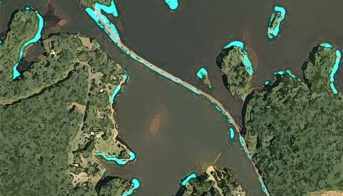
In September 1999, to provide a detailed assessment of the distribution of Justicia americana and other aquatic vegetation throughout the Narrows Reservoir, the Center for Applied Aquatic Ecology ortho-rectified aerial photographs of the reservoir for GIS evaluation.
This map was produced from aerial photographs taken at a scale of 1:24,000. Vertical aerial photography was completed at 6,000 feet ATM consisting of approximately 6 lines and 56 exposures, with 60% overlap.
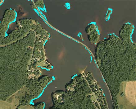
The map was brought into a GIS program, and Justicia americana beds were highlighted and mapped out.
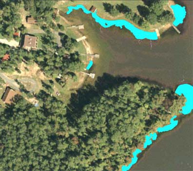
Once highlighted, the total biomass and distribution of Justicia americana were determined.